 |
Keys
to the Kingdom National Anthem The Office Geography and Environment |
Western Jordan has essentially a Mediterranean climate with a hot, dry summer, a cool, wet winter and two short transitional seasons. However, about 75% of the country can be described as having a desert climate with less than 200 mm. of rain annually. Jordan can be divided into three main geographic and climatic areas: the Jordan Valley, the Mountain Heights Plateau, and the eastern desert, or Badia region. |
|
|
The Jordan Valley, which extends down the entire western flank of Jordan, is the country’s most distinctive natural feature. The Jordan Valley forms part of the Great Rift Valley of Africa, which extends down from southern Turkey through Lebanon and Syria to the salty depression of the Dead Sea, where it continues south through Aqaba and the Red Sea to eastern Africa. This fissure was created 20 million years ago by shifting tectonic plates. |
The northern segment of the Jordan Valley, known in Arabic as the Ghor, is the nation’s most fertile region. It contains the Jordan River and extends from the northern border down to the Dead Sea. The Jordan River rises from several sources, mainly the Anti-Lebanon Mountains in Syria, and flows down into Lake Tiberias (the Sea of Galilee), 212 meters below sea level. It then drains into the Dead Sea which, at 407 meters below sea level, is the lowest point on earth. The river is between 20 and 30 meters wide near its endpoint. Its flow has been much reduced and its salinity increased because significant amounts have been diverted for irrigational uses. Several degrees warmer than the rest of the country, its year-round agricultural climate, fertile soils, higher winter rainfall and extensive summer irrigation have made the Ghor the food bowl of Jordan. |
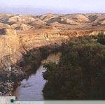 The Jordan River. © Zohrab |
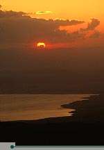 Dead Sea at night. © Zohrab |
The Jordan River ends at the Dead Sea, which, at a level of over 407 meters below sea level, is the lowest place on the earth’s surface. It is landlocked and fed by the Jordan River and run-off from side wadis. With no outlet to the sea, intense evaporation concentrates its mineral salts and produces a hypersaline solution. The sea is saturated with salt and minerals–its salt content is about eight times higher than that of the world’s ocean–and earns its name by virtue of the fact that it supports no indigenous plant or animal life. The Dead Sea and the neighboring Zarqa Ma’een hot springs are famous for their therapeutic mineral waters, drawing visitors from all over the world. |
South of the Dead Sea, the Jordan Valley runs on through hot, dry Wadi ‘Araba. This spectacular valley is 155 kilometers long and is known for the sheer, barren sides of its mountains. Its primary economic contribution is through potash mining. Wadi ‘Araba rises from 300 meters below sea level at its northern end to 355 meters above sea level at Jabal Risha, and then drops down again to sea level at Aqaba. |
|
The seaside city of Aqaba is Jordan’s only outlet to the sea. Its 40 kilometer-long coastline houses not only a tourist resort and Jordan’s only port, but also some of the finest coral reefs in the world. The rich marine life of these reefs provides excellent opportunities for snorkeling and diving. |
|
The highlands of Jordan separate the Jordan Valley and its margins from the plains of the eastern desert. This region extends the entire length of the western part of the country, and hosts most of Jordan’s main population centers, including Amman, Zarqa, Irbid and Karak. We know that ancient peoples found the area inviting as well, since one can visit the ruins of Jerash, Karak, Madaba, Petra and other historical sites which are found in the Mountain Heights Plateau. These areas receive Jordan’s highest rainfall, and are the most richly vegetated in the country. |
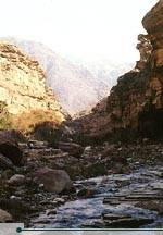 Wadi Mujib. © Jad Al Younis, Discovery Eco-Tourism |
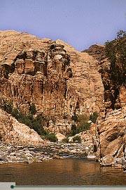 Wadi Finan. © Jad Al Younis, Discovery Eco-Tourism |
The region, which extends from Umm Qais in the north to Ras an-Naqab in the south, is intersected by a number of valleys and riverbeds known as wadis. The Arabic word wadi means a watercourse valley which may or may not flow with water after substantial rainfall. All of the wadis which intersect this plateau, including Wadi Mujib, Wadi Mousa, Wadi Hassa and Wadi Zarqa, eventually flow into the Jordan River, the Dead Sea or the usually-dry Jordan Rift. Elevation in the highlands varies considerably, from 600 meters to about 1,500 meters above sea level, with temperature and rainfall patterns varying accordingly. The northern part of the Mountain Heights Plateau, known as the northern highlands, extends southwards from Umm Qais to just north of Amman, and displays a typical Mediterranean climate and vegetation. This region was known historically as the Land of Gilead, and is characterized by higher elevations and cooler temperatures. |
|
|
|
Comprising around 75% of Jordan, this area of desert and desert steppe is part of what is known as the North Arab Desert. It stretches into Syria, Iraq and Saudi Arabia, with elevations varying between 600 and 900 meters above sea level. Climate in the Badia varies widely between day and night, and between summer and winter. Daytime summer temperatures can exceed 40°C, while winter nights can be very cold, dry and windy. Rainfall is minimal throughout the year, averaging less than 50 millimeters annually. Although all the regions of the Badia (or desert) are united by their harsh desert climate,similar vegetation types and sparse concentrations of population, they vary considerably according to their underlying geology. |
The volcanic formations of the northern Basalt Desert extend into Syria and Saudi Arabia, and are recognizable by the black basalt boulders which cover the landscape. East of the Basalt Desert, the Rweishid Desert is an undulating limestone plateau which extends to the Iraqi border. There is some grassland in this area, and some agriculture is practiced there. Northeast of Amman, the Eastern Desert is crossed by a multitude of vegetated wadis, and includes the Azraq Oasis and the Shomari Wildlife Reserve. |
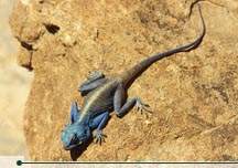 Brightly blue lizard, Petra. © Ammar Khammash |
| To the south of Amman is the Central Desert, while Wadi Sarhan on Jordan’s eastern border drains north into Azraq. Al-Jafr Basin, south of the Central Desert, is crossed by a number of broad, sparsely-vegetated wadis. South of al-Jafr and east of the Rum Desert, al-Mudawwara Desert is characterized by isolated hills and low rocky mountains separated by broad, sandy wadis. The most famous desert in Jordan is the Rum Desert, home of the wondrous Wadi Rum landscape. Towering sandstone mesas dominate this arid area, producing one of the most fantastic desert-scapes in the world. |